Browse Public Maps
Filter by Model
 Manage All Models
Filter by Language
 All Languages
 English (United States)
 Portuguese (Brazil)
Sort by
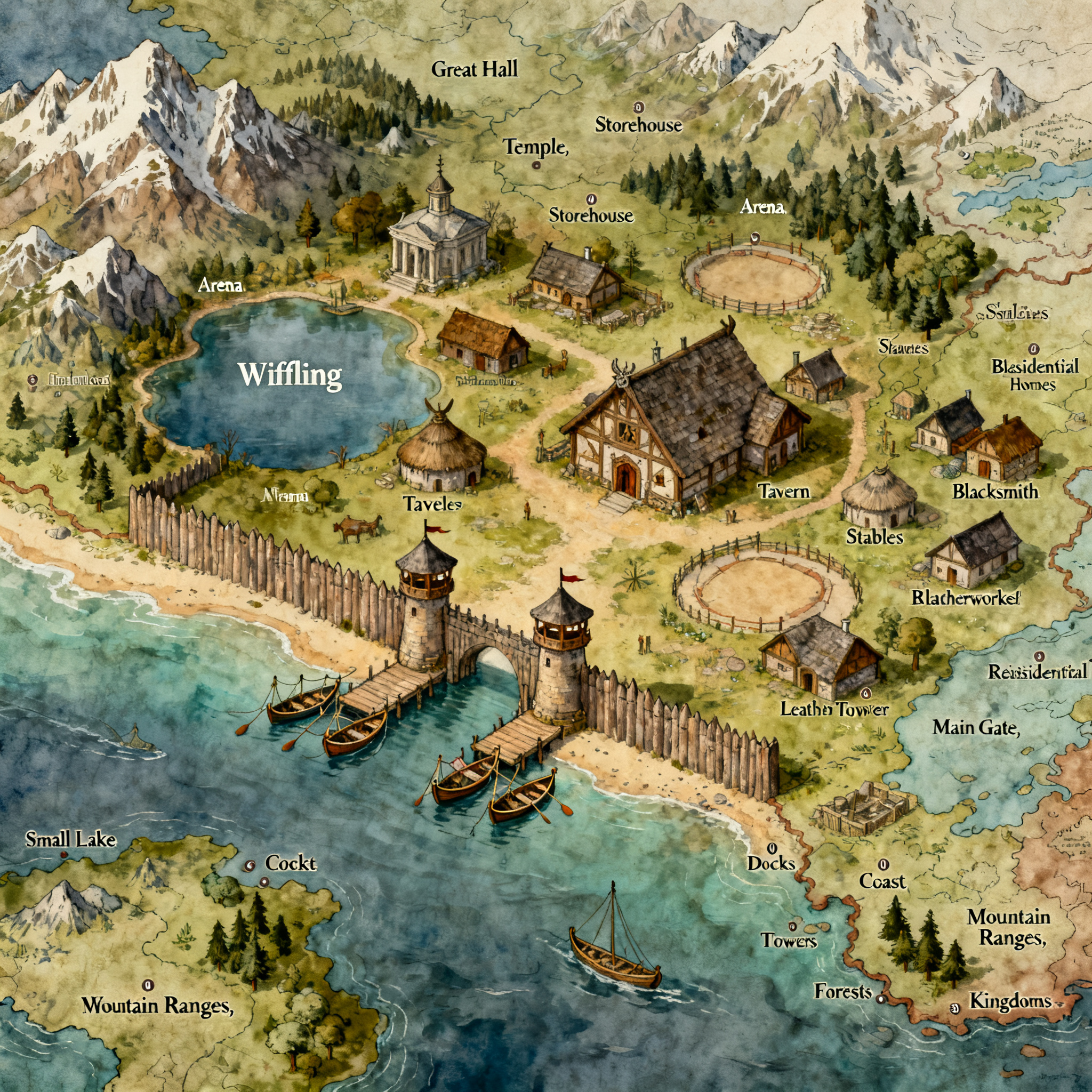
Prompt: A Viking village with a pallisade wall. The village rests on the coast of a small lake, which appears in the top left of the image. The main gate opposite the lake and is flanked by a pair of watch towers. The pallisade does not fully encircle the village, but runs up to the edge of the water. There are two docks between the walls, where they end in the water. Small fishing and row boats pulled up on shore adjacent to the docks. Within the village there is a great hall, temple, storehouse, small simple arena, tavern, stables, blacksmith, leatherworker, and other buildings that make sense in that setting. The great hall is situated near the center of the village, though closer to the water than the main gate. It is arranged such that the front doors of the great hall face the main gate. In addition, there are 30 residential homes ranging in size from small to medium size. The name of the village is Wiffling.

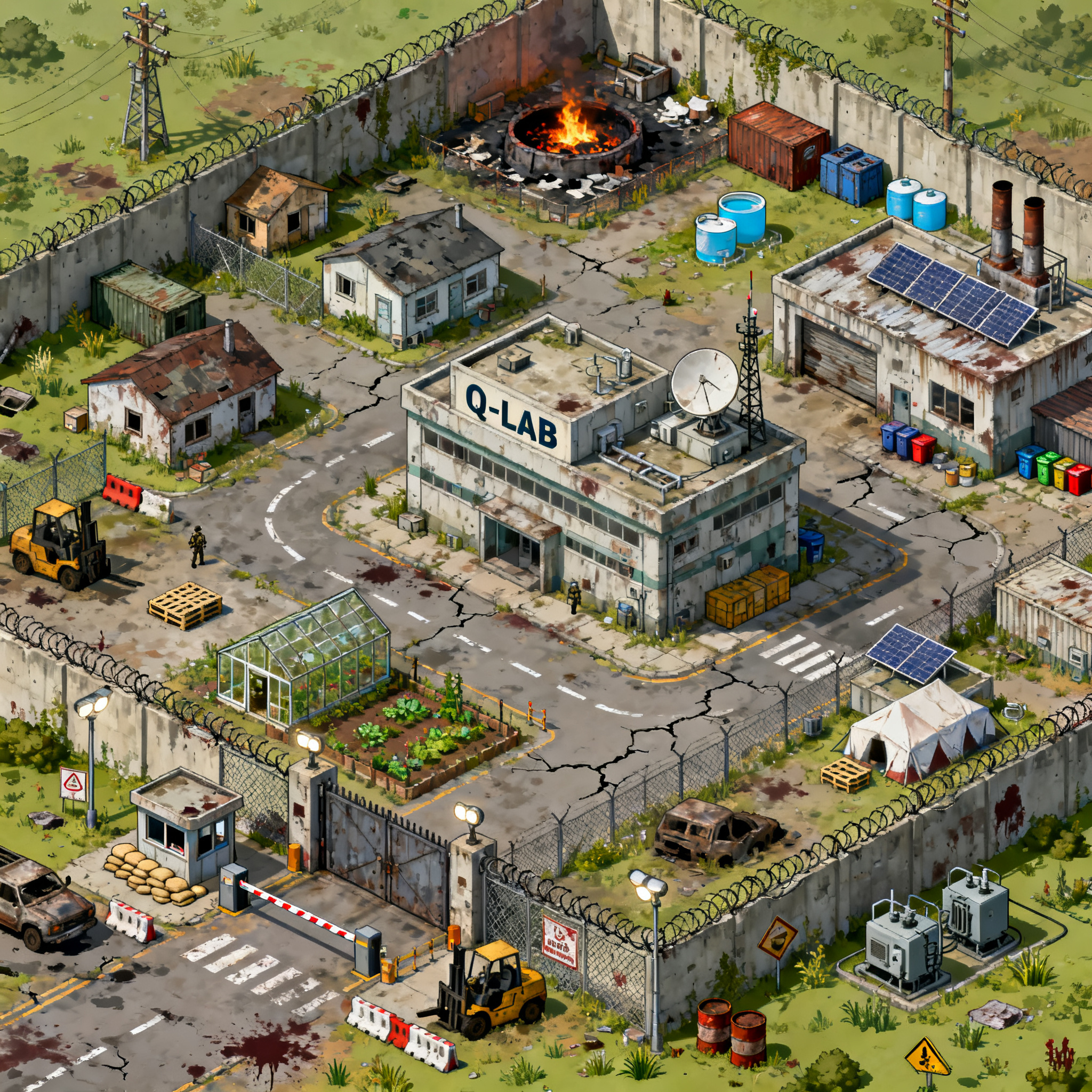
Prompt: TOP-DOWN / 3/4 VIEW GAME MAPCreate a highly detailed post-apocalyptic survivor compound map for a zombie survival game, viewed in a Stardew Valley-style 3/4 overhead perspective. The map is designed as a playable game environment, not concept art.Resolution: 2560 x 2560 pixels.The entire map is a fortified quarantine compound surrounded by tall concrete walls, chain-link fencing, razor wire, security barriers, and guard posts. The compound should feel abandoned but still functional, with evidence of emergency operations and survival efforts.MAIN FEATURES:• Large reinforced main entrance gate at the southern edge of the compound• Security checkpoint with boom gates, guard shack, sandbags, floodlights, barricades, abandoned vehicles• Central "Q-LAB" research facility as the largest building on the map• Multiple smaller laboratory annex buildings• Medical clinic / infirmary building• Food storage warehouse• Supply depot and logistics warehouse• Staff accommodation houses and small cabins• Maintenance workshop and vehicle garage• Communications building with antennas and satellite dishes• Industrial incinerator facility with burn pit, chimneys and waste processing area• Community garden and greenhouse area producing food• Small water tanks and utility infrastructure• Solar panels and backup generators• Open courtyards and roads connecting all locationsENVIRONMENT DETAILS:• Cracked concrete roads• Faded road markings• Scattered cargo containers• Storage crates and pallets• Forklifts and abandoned utility vehicles• Fences separating key sectors• Emergency tents• Medical waste bins• Warning signs• Fire barrels• Power poles and generators• Weed overgrowth and neglected landscaping• Debris and signs of previous zombie attacksGAMEPLAY LAYOUT:The map should be designed as a playable arena for a wave-based zombie survival game.Create:• Multiple pathways for player movement• Open combat spaces• Chokepoints near gates and buildings• Narrow alleys between structures• Defensible positions• Exploration routes around the perimeter• Clear landmarks so players can navigate easilyVISUAL STYLE:• Stardew Valley inspired camera angle• Realistic proportions• Handcrafted game-map appearance• High readability for gameplay• Detailed but uncluttered• Consistent scale throughout• Suitable for player movement and enemy pathfinding• No UI elements• No characters• No zombies visibleTHEME:A former quarantine and research facility struggling to survive a zombie apocalypse. The location should feel like a mix between a military outpost, medical research center, refugee camp, and survival settlement.Output as a complete seamless game map with no empty areas and no transparent background.
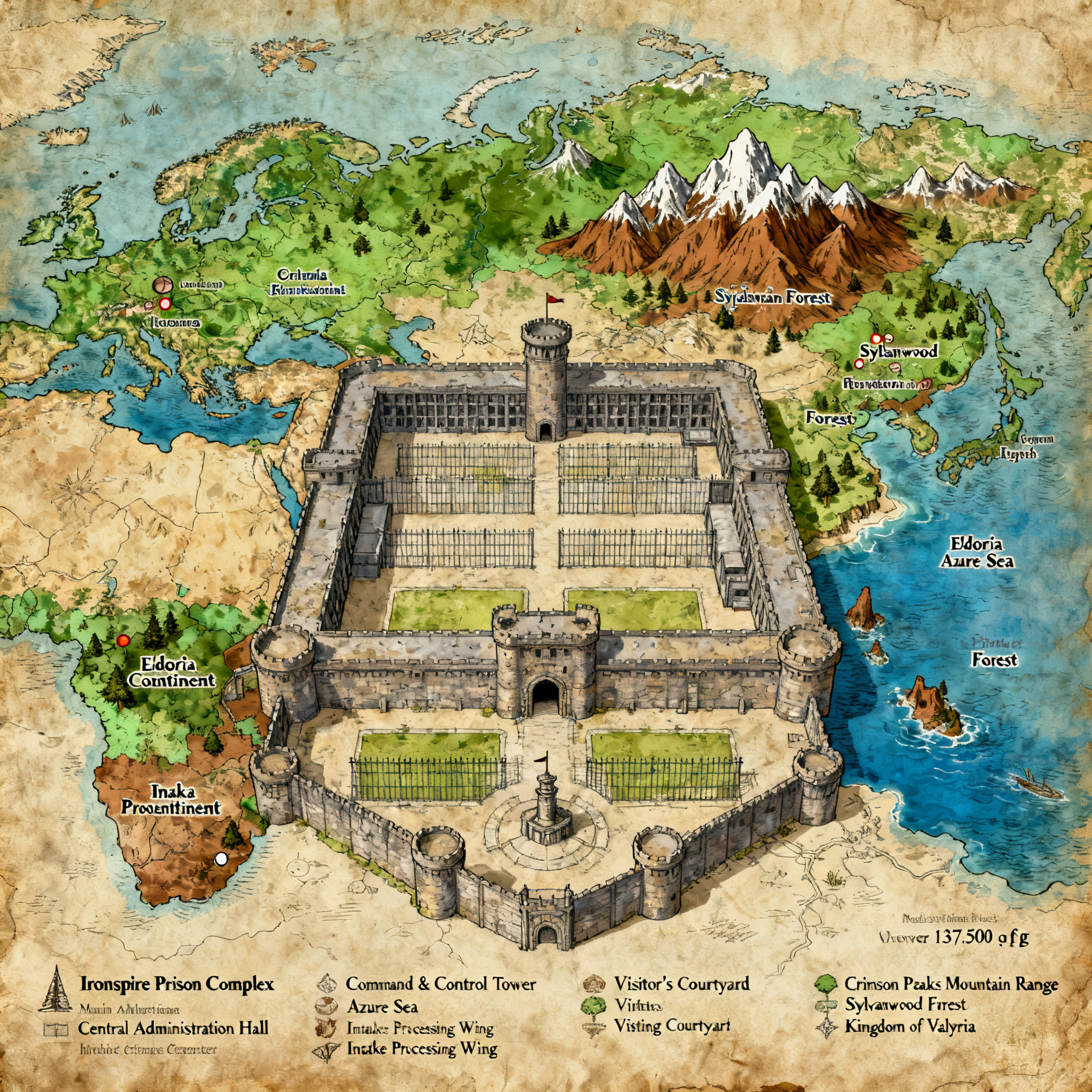
Prompt: Make a rpg battlemap of a very large prison facility Over 137,500 square feet keep the administration, control center, visiting, and intake all together in the front
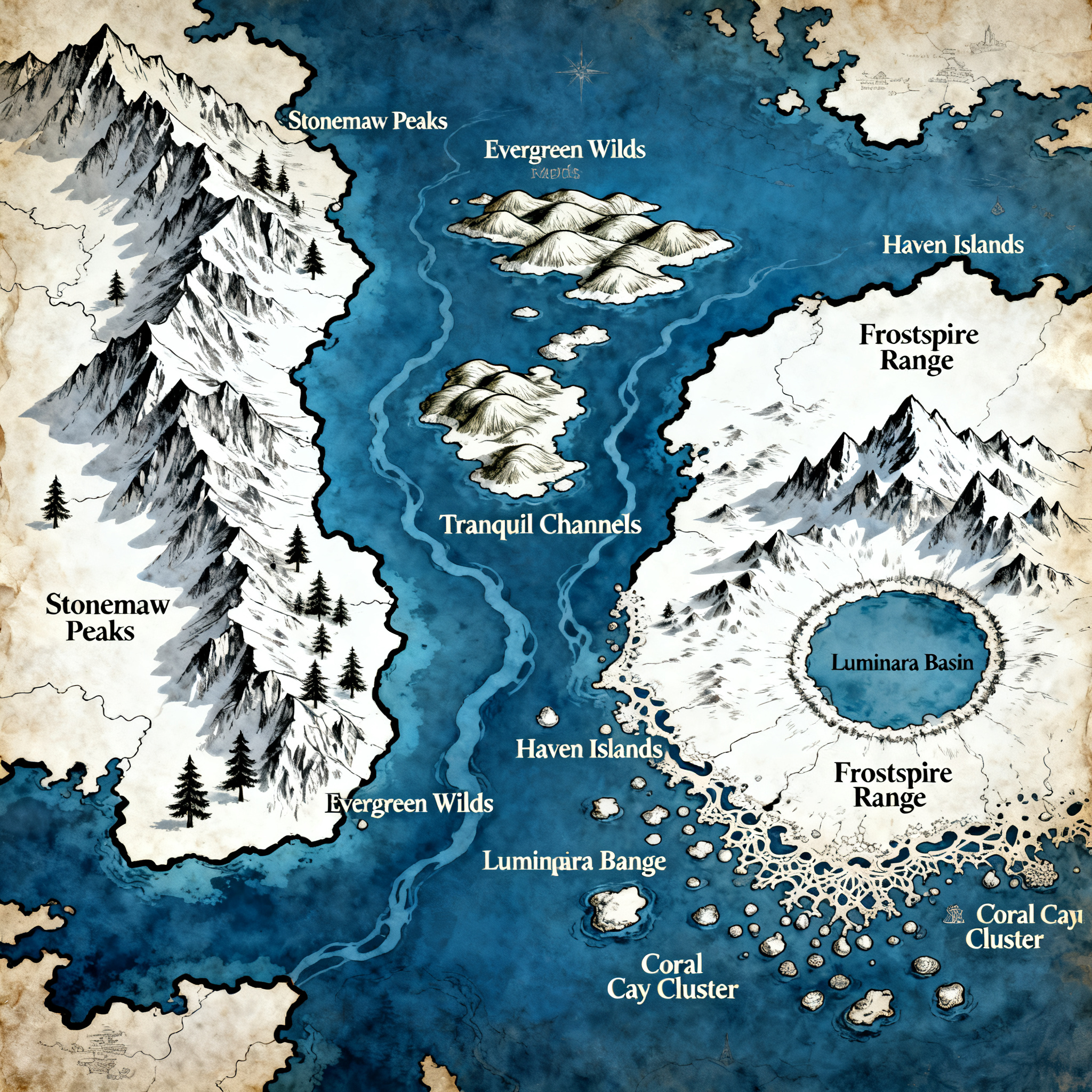
Prompt: The map is a high-fantasy depiction of a large archipelago featuring deep blue oceans, clean white mainlands, and sharp black borders for the mainlands. It shows three major landmasses, which are separated by a series of winding ocean straits and channels: a rugged western mainland having a huge north-south mountain range and pine forests; a central group of islands with rolling hills and inland waterways; and a vast eastern mainland with a northern cluster of mountains, an internal ring lake, and a highly intricate southeastern coast lined with numerous small islands.
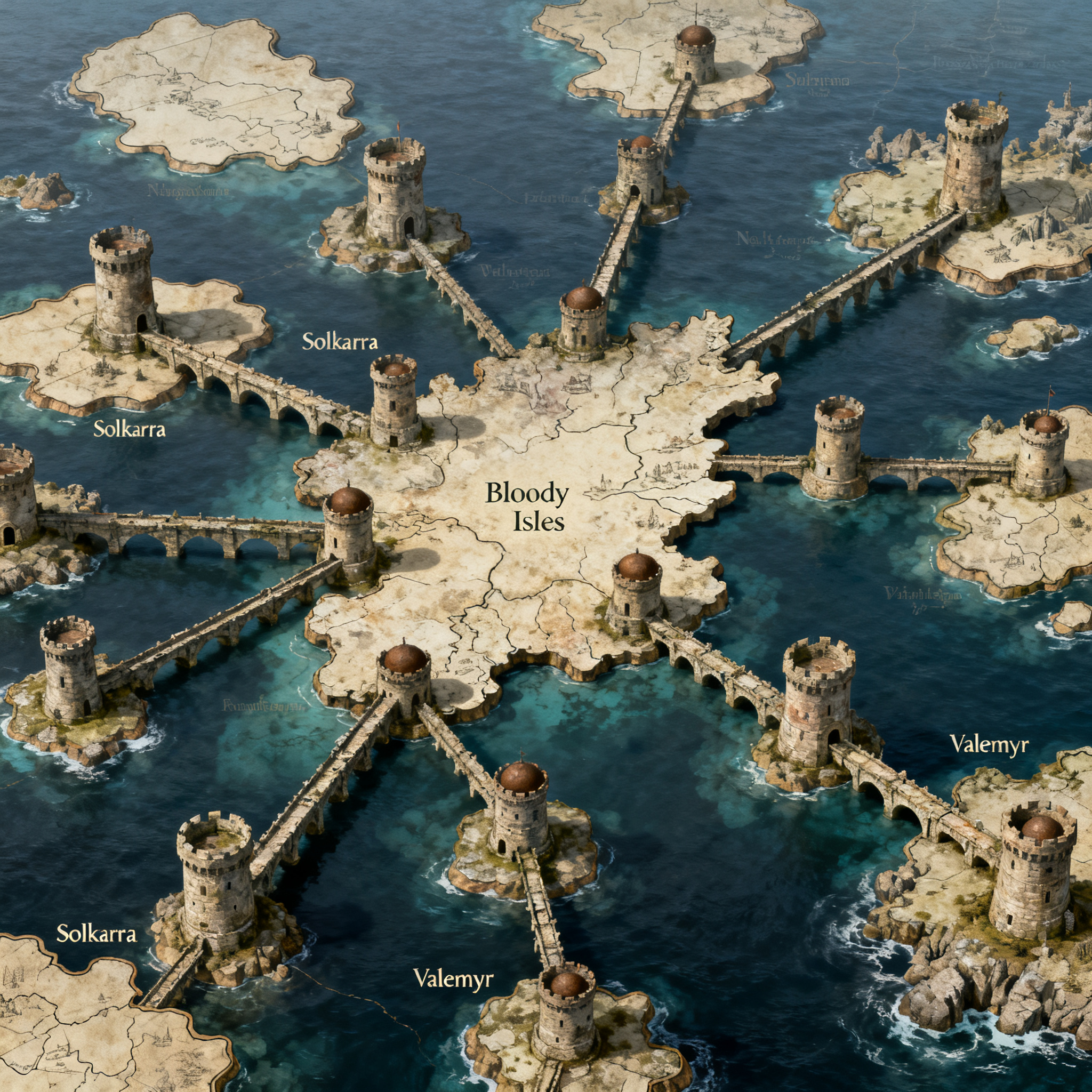
Prompt: Transform the attached hand-drawn sketch of THE SOUTH into a highly detailed, professional fantasy map suitable for a published epic fantasy novel, inspired by the cartographic style of A Song of Ice and Fire.CRITICAL: The original sketch is the definitive geographical reference. Do not redesign, reinterpret, or rearrange its structure.Geography and layoutThe South is a vast archipelago consisting of numerous isolated islands connected by an ancient, interconnected system of bridges and fortified towers.Follow these rules precisely:Every irregular enclosed shape represents an island. Preserve its approximate outline, size, position, and distance from neighboring islands.Every drawn line represents a physical bridge spanning the sea. These are NOT roads, rivers, borders, or coastlines.Every solid dot represents a tower. Towers stand at significant points along the bridge system, especially junctions where multiple bridges converge.Preserve the original bridge connections and their intersections. Do not connect islands that are disconnected in the sketch.Preserve the geographical arrangement of the northern, central, eastern, western, and southern island groups.The largest central island is labeled Bloody Isles. Preserve its location and distinctive shape.Retain the place names visible in the original sketch, including Solkarra and Valemyr, placing each in its corresponding location.The empty spaces between islands are open sea, not land.The bridgesThe bridges are the defining feature of this world.Depict them as extraordinarily long, ancient stone constructions stretching across vast distances of open water. Their appearance should suggest centuries of engineering, construction, warfare, and repair.Some bridges connect islands directly, while others meet at isolated towers surrounded entirely by water.The towers should be imposing medieval fortifications built into the bridge network, with recognizable defensive architecture.Bridges should remain relatively thin on the map, while towers should be represented by distinctive but restrained cartographic symbols.Artistic directionCreate an authentic medieval fantasy map with intricate inkwork on aged parchment.Use finely detailed coastlines, subtle coastal cliffs, delicate stippling, restrained sea shading, miniature fortified tower illustrations, and carefully rendered stone bridges.The aesthetic should be historical, grounded, and atmospheric, evoking the maps found in the opening pages of George R. R. Martin's novels.Use a warm ivory parchment background, dark brown and black ink, restrained sepia accents, elegant serif lettering, and a small ornamental compass rose.CompositionPerfectly overhead, flat 2D cartographic perspective.Match the original sketch's overall proportions and relative geographical positions.Preserve the entire network of islands, towers, and bridges.Make the unusual bridge network immediately recognizable.Maintain clear visual separation between land, water, towers, and bridges.High-resolution professional book-quality illustration.Do not introduce large continents, additional islands, new bridges, invented tower junctions, mountains that obscure the geography, modern infrastructure, or decorative elements that alter the original map.The final result must look like a master cartographer meticulously illustrated the exact geography shown in the hand-drawn reference, not like an AI invented a new fantasy map.
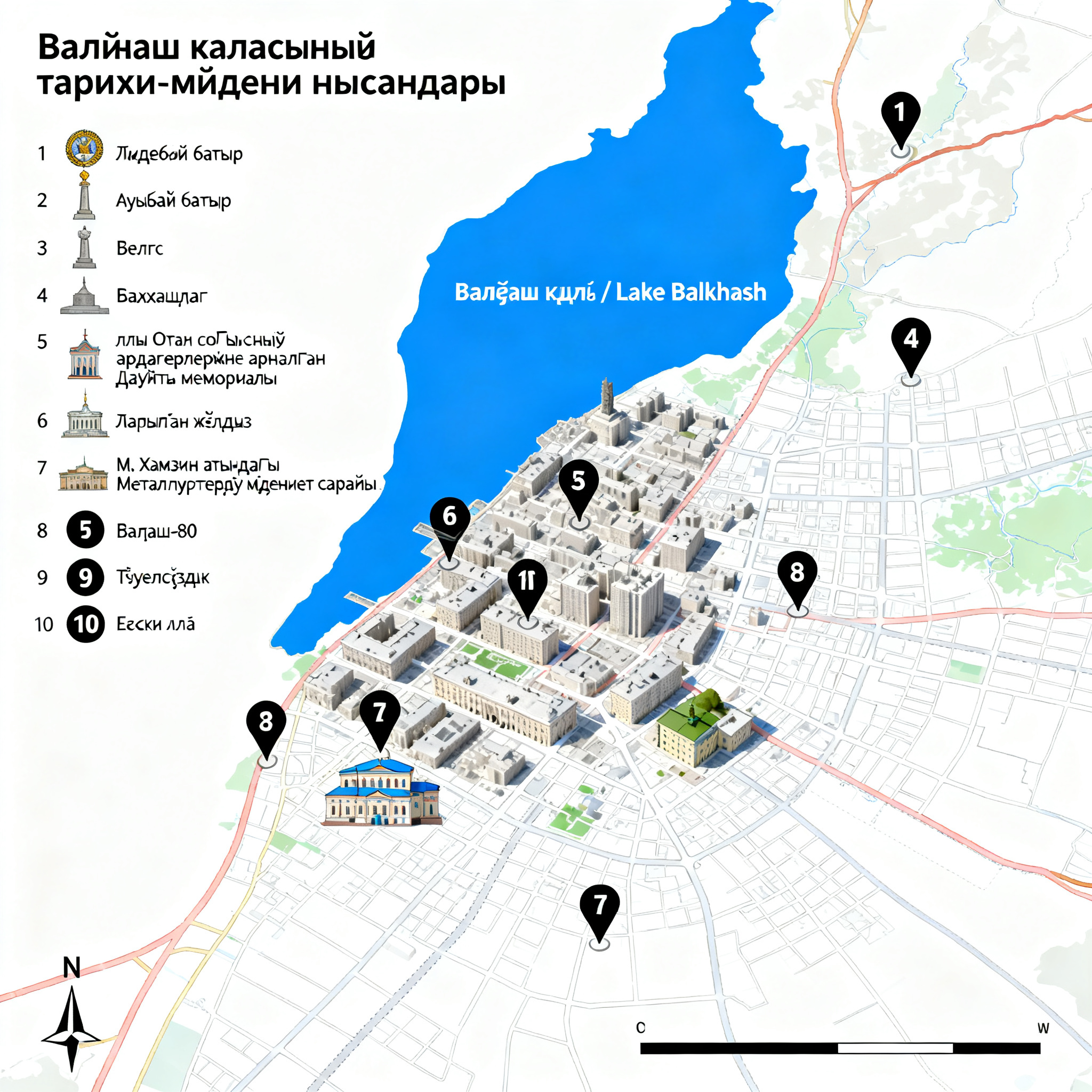
Prompt: Create a detailed, accurate-looking academic heritage tourism map of Balkhash city, Kazakhstan, designed for a school research project about preserving and developing Balkhash’s industrial and historical heritage.Show Balkhash city and the surrounding area, with Lake Balkhash clearly visible and prominently labeled. Use a clean top-down cartographic view with realistic city geography, major streets and urban areas simplified enough to keep the map readable.Mark and label these 10 sightseeing and historical locations in Balkhash:«Жидебай батыр» ескерткіші«Ағыбай батыр» ескерткіші«Белгі» ескерткіші«Балхашлаг» лагері«Ұлы Отан соғысының ардагерлеріне арналған Даңқты мемориалы»«Жарылған жұлдыз»«М. Хамзин атындағы Металлургтердің мәдениет сарайы»«Балқаш-80» стеласы«Тәуелсіздік» стеласыЕскі алаңUse numbered heritage-site markers (1–10) on the map and provide a clear legend on the side matching every number to its location. Make the markers visually distinct but not oversized.Use different subtle symbols for different categories:monuments/memorials — monument iconhistorical sites — historical building iconcultural site — cultural building iconsquares/stelae — landmark iconClearly distinguish Lake Balkhash using a blue area and label it «Балқаш көлі / Lake Balkhash». Highlight the urban area of Balkhash and show the relationship between the historical sites and the lake.Style: professional cartographic design, clean academic infographic, suitable for a Kazakhstan school research competition, white/light background, restrained colors, readable typography, precise map composition, north arrow, scale bar, legend, title «Балқаш қаласының тарихи-мәдени нысандары».Important: Do not invent additional monuments or attractions. Do not add fictional streets, buildings, landmarks, or locations. Keep all 10 requested locations as the focus of the map. Make the labels legible and preserve the correct Kazakh names.

Prompt: fantasy city in the clouds


Prompt: The map is old, in shades of brown. It is divided by the sea into two halves, a left and a right one. The left side is a larger landmass than the right one.
In the top left corner, there are two cities next to each other: Mengusovce and Kanada. Next to these cities, there is a mountain called Baba. Below these cities, there is another city called Poprad.
On the right side of the left landmass (still inland), there are the cities Kežmarok and Spišská Belá. Near these cities, there is the only port city, Kubachy.
A river called Poprad runs across the entire continent. It flows through Mengusovce, Poprad, Kežmarok, and Spišská Belá, and empties into the sea in the city of Kubachy.
Between Poprad and Kežmarok, there is also one large lake called Štrkopiesky, next to which there is a small village called Lučivná.
In the empty areas of the map, add some small trees. Do not forget that the entire map should look fairy-tale-like and as if it comes from the medieval period.

Prompt: Antioch – Map-Only EssentialsCity LayoutLarge walled city at a major crossroadsRiver runs through or along the south side, connecting inland to coastBridges are prominent and well-engineeredCity divided into 8 clearly defined sectorsMajor buildings are oversized landmarks visible from afarKey Geographic FeaturesRiver / Harbor Zone (South)Central Plaza / High DistrictMultiple Gates (fast-travel hubs)Primary Trade Roads entering from at least 3 directionsParks / Green District in northwestSectors (Map Labels Only)A – Central DistrictAthena Temple (huge landmark)Main Gate (heavily guarded)Government buildingsRed Coats HQMemorial Gardens (statue)B – Trade Quarter (East)Merchant GuildWarehousesCaravan yardsTrade GateC – Scholar District (North)AcademyLibrariesScholar housingD – Artisan Quarter (West)WorkshopsBuilder Guild #2E – Arcane District (Southeast)Magic GuildAlchemists / EnchantersF – Harbor / River District (South)DocksShipyardsFishing marketBuilder Guild #3River GateDensest, messiest streetsG – Common Quarter (Southwest)Dense housingGeneral marketsShrinesH – Garden District (Northwest)ParksNoble estatesLow density, open spaceGates (Icons on Map)Main Gate → Sector A (hub)Trade Gate → Sector BRiver Gate → Sector FRoad LogicThick roads connect:Trade Quarter ↔ Central DistrictHarbor ↔ Trade QuarterCentral District ↔ All other sectorsSmaller residential roads branch outwardTraffic funnels controlled at choke points near gates and bridgesArchitectural Notes (Visual Cues)Older, blocky dwarven stone in coreNewer imperial styles layered outwardMixed building heightsClean streets everywhere except Sectors F & G


Prompt: Top-down VTT battlemap of an abandoned medieval roadside inn in a low fantasy Aventurian style.
The building is called “The Old Oak Inn” and stands near a massive ancient oak tree just outside the map area. The inn has been abandoned for over twenty years and looks as if it was left suddenly, furniture still intact but covered in thick dust and spider webs.
Ground floor: a cozy tavern common room with a small wooden bar counter, a wide stone fireplace, around twenty mismatched chairs, three small tables, and one long dining table. The walls are decorated with many framed paintings showing landscapes, towns, and buildings of the surrounding county. A long chandelier with several candles hangs from the ceiling. Everything is dusty but mostly undamaged. Behind the bar is an empty cash box.Exterior details: behind the inn is the destroyed cellar hatch, and about ten meters away stands a small wooden outhouse.
Style: realistic medieval fantasy, muted colors, atmospheric lighting, top-down perspective, highly detailed, gridless, no labels, no text, optimized for VTT use.

Prompt: Top-down VTT battlemap of an abandoned medieval roadside inn in a low fantasy Aventurian style.
The building is called “The Old Oak Inn” and stands near a massive ancient oak tree just outside the map area. The inn has been abandoned for over twenty years and looks as if it was left suddenly, furniture still intact but covered in thick dust and spider webs.
Ground floor: a cozy tavern common room with a small wooden bar counter, a wide stone fireplace, around twenty mismatched chairs, three small tables, and one long dining table. The walls are decorated with many framed paintings showing landscapes, towns, and buildings of the surrounding county. A long chandelier with several candles hangs from the ceiling. Everything is dusty but mostly undamaged. Behind the bar is an empty cash box.
Upper floor: a sleeping area with one large dormitory containing nine simple wooden beds, plus three small guest rooms with two beds each. There is also a small private apartment for the innkeeper, including a wardrobe with old clothes and a small table holding a drawing of a family. The upper floor is dusty, quiet, and filled with spider webs of various sizes.
Basement: accessed via a broken wooden hatch at the back of the building. The hatch was once locked but has been smashed open; broken planks lie at the bottom of a steep wooden staircase leading three meters down. Inside the cellar are several full wine barrels, one huge half-filled beer barrel, mold-covered hams hanging from the ceiling, a large cupboard with tools, and shelves and crates once used for storing food, many now empty and scattered across the floor.
Exterior details: behind the inn is the destroyed cellar hatch, and about ten meters away stands a small wooden outhouse.
Style: realistic medieval fantasy, muted colors, atmospheric lighting, top-down perspective, highly detailed, gridless, no labels, no text, optimized for VTT use.

Prompt: O mundo conhecido é formado por um único continente gigantesco, tão vasto que muitos acreditam que viajar de uma extremidade à outra levaria gerações. Dentro dele existem seis grandes reinos, alguns bem definidos, outros fragmentados e instáveis. No coração do continente ergue-se a Grande Cordilheira Central, que separa culturas, espécies e ideologias. Os Três Reinos Humanos (Leste da Cordilheira)1. Reino de Valdren O Reino da Coroa e da LeiValdren é o maior e mais organizado dos reinos humanos. Governado por uma monarquia antiga, sua força vem de exércitos bem treinados, estradas extensas e forte controle político. Valdren vê as 100 Masmorras como recursos estratégicos: poder, relíquias e influência.É comum que aventureiros sejam oficialmente licenciados pela coroa para explorar masmorras em nome do reino.2. Reino de AsterhallO Reino das Espadas LivresAsterhall é um reino expansionista, marcado por constantes guerras e disputas territoriais. A nobreza é militarista, e o trono frequentemente muda de mãos através de conflitos internos.Muitas masmorras ficam em suas fronteiras, e diversas casas nobres acreditam que reunir fragmentos das relíquias é a chave para dominar todo o continente.3. Principado de LythorienO Reino da Fé e do ConhecimentoMenor que os outros dois, Lythorien é governado por um concílio religioso e arcano. Templos, bibliotecas e academias mágicas dominam suas cidades.Para Lythorien, as masmorras não são apenas desafios, mas provas divinas ou ecos de um pacto antigo. Muitos clérigos e magos acreditam que unir uma relíquia completa pode despertar algo maior… ou terrível. Reino Élfico (Oeste da Cordilheira)4. Sylvael’ThalasO Reino dos Bosques EternosSylvael’Thalas é um reino élfico antigo, integrado às florestas vivas do oeste. Suas cidades não são construídas, mas cultivadas. Os elfos veem a cordilheira como uma ferida no mundo, e as masmorras como anomalias que desequilibram a natureza.Curiosamente, muitas masmorras alteram completamente a fauna e a flora ao seu redor, criando zonas corrompidas ou sagradas — algo que preocupa profundamente os elfos.Os Dois Reinos Quebrados (Espalhados pelo Continente)Esses reinos não possuem fronteiras claras, existindo como territórios fragmentados, cidades-estado, fortalezas móveis ou domínios subterrâneos.5. As Terras Fraturadas de Khar’DuumOs Reinos Perdidos da PedraAntigo domínio de anões, gigantes da colina e outras raças da terra, Khar’Duum foi destruído em um cataclismo antigo — possivelmente ligado às relíquias.Hoje, suas ruínas se espalham sob montanhas, desertos e cavernas profundas. Clãs sobreviventes disputam poder, e muitas masmorras foram erguidas sobre antigas cidades soterradas.6. A Confederação Errante de VharûnO Reino sem TronoVharûn não é um reino fixo, mas uma rede de povos deslocados: orcs, tieflings, dragonborn, goblinoides e outras raças rejeitadas pelos grandes reinos.Eles se organizam em caravanas, fortalezas temporárias e cidades nômades. Para Vharûn, as masmorras são santuários de poder e símbolos de libertação — cada fragmento de relíquia é visto como uma chance de romper a dominação humana. As 100 Masmorras e as RelíquiasCada uma das cem masmorras é um ecossistema próprio, com fauna e flora únicas, muitas vezes completamente desconectadas do ambiente externo.

Prompt: A gigantic continent divided among 6 nations/kingdoms. Running through the center of the continent from top to bottom is a large mountain range, found in abundance in both the northern and southern hemispheres. To the left of the mountains are the more natural kingdoms, such as elves, dwarves, gnomes, and others. To the right are the humans. Scattered throughout the continent are 100 dungeons.

Prompt: A gigantic continent divided among 6 nations/kingdoms. Running through the center of the continent from top to bottom is a large mountain range, found in abundance in both the northern and southern hemispheres. To the left of the mountains are the more natural kingdoms, such as elves, dwarves, gnomes, and others. To the right are the humans. Scattered throughout the continent are 100 dungeons.

Prompt: A gigantic continent divided among 6 nations/kingdoms. Running through the center of the continent from top to bottom is a large mountain range, found in abundance in both the northern and southern hemispheres. To the left of the mountains are the more natural kingdoms, such as elves, dwarves, gnomes, and others. To the right are the humans. Scattered throughout the continent are 100 dungeons.

Prompt: Top-down 2D tactical battle map, 14x14 octagonal tiles, symmetrical layout. Each tile displays a terrain bonus number: +0 = flat land or road, +1 = low hill, +2 = medium hill, +3 = high peak. Roads are smooth gray paths on +0 tiles. Hills have visible elevation with rocks or grass, darker for higher tiles. Central town/objective on flat terrain, connected by winding roads and small rivers with wooden bridges. Water tiles in blue, forests/trees on some +0/+1 tiles as obstacles. Octagonal grid outlines visible but subtle. Bright, clear colors, numbers readable and centered on each tile. Strategic and easy-to-read layout for tabletop gameplay.

Prompt: a heroes of might and magic 3 inspired map with gassrands and lots of points of interest

@generor
871 creations11 reviews0 commentsJoined Nov 2024
The official Generor account.
generor.comView Profile →
Prompt: a heroes of might and magic 3 inspired map with gassrands and lots of points of interest
@generor
871 creations11 reviews0 commentsJoined Nov 2024
The official Generor account.
generor.comView Profile →
Prompt: a heroes of might and magic 3 inspired map with gassrands and lots of points of interest
@generor
871 creations11 reviews0 commentsJoined Nov 2024
The official Generor account.
generor.comView Profile →
Prompt: a heroes of might and magic 3 inspired map with gassrands and lots of points of interest
@generor
871 creations11 reviews0 commentsJoined Nov 2024
The official Generor account.
generor.comView Profile →
Prompt: a heroes of might and magic 3 inspired map with gassrands and lots of points of interest
@generor
871 creations11 reviews0 commentsJoined Nov 2024
The official Generor account.
generor.comView Profile →